Score
A more accurate weather forecast could start with these high-flying drones
Meteomatics, a Swiss weather technology company, has introduced Strato, a multicopter drone designed to collect atmospheric data at higher altitudes than traditional weather balloons. Strato can provide real-time vertical profiles of the atmosphere, significantly improving weather forecasting accuracy and reducing operational costs. Brand strategists can take note of how innovative technology can disrupt traditional industries and create new market opportunities.
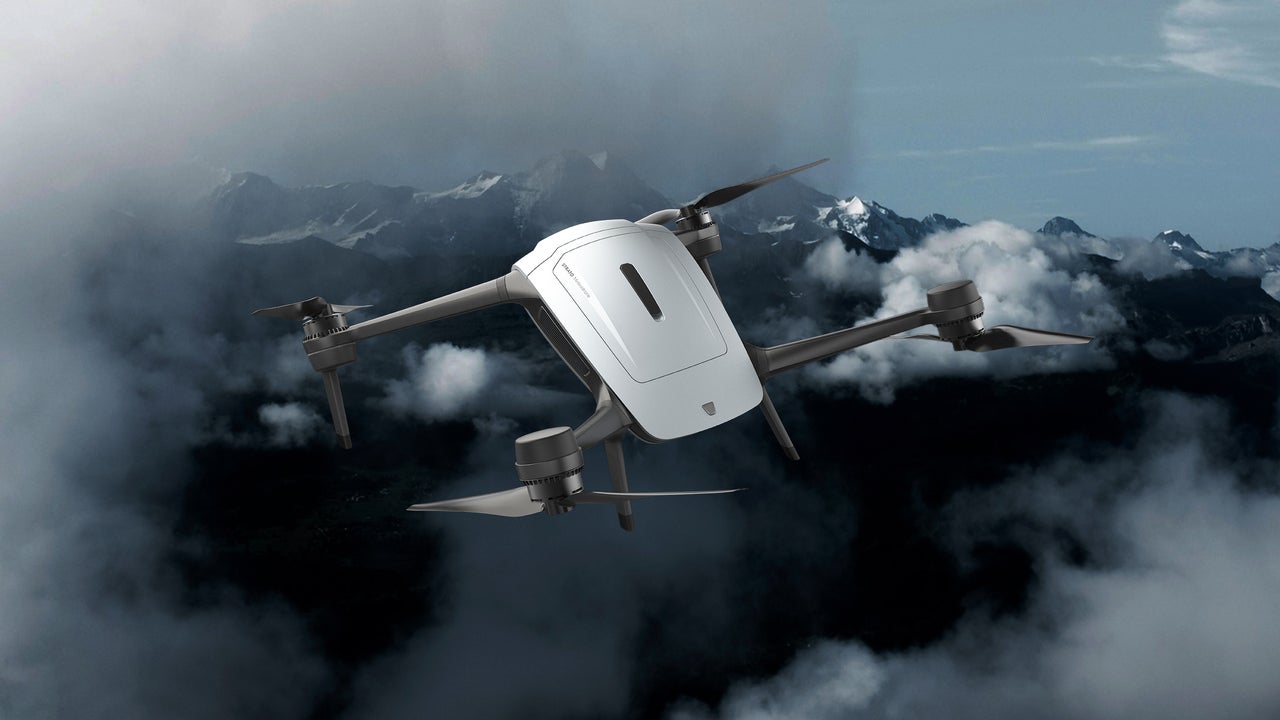
FastCompany: For nearly a century, reading the upper sky has meant tying a box of sensors to a balloon, letting go, and kissing the hardware goodbye. And they only go up at fixed times. If a storm starts brewing between launches, nobody’s up there to see it. Meteomatics , a Swiss weather technology company, thinks we can get better weather data. It recently introduced Strato, a multicopter drone made to study Earth’s atmosphere. It is designed to reach higher altitudes of the troposphere—the part of the atmosphere where weather happens—than weather balloons, at a fraction of the price.
And once its mission is complete, it returns to its launch site ready to go back up again. A weather instrument you can fly over and over, wherever and whenever you need it, could change how we watch the sky and predict the weather. [Image: Courtesy Meteomatics] Data on demand According to Meteomatics, no drone before Strato could profile the atmosphere all the way from the ground into the stratosphere on demand. As Strato climbs, it reads temperature, humidity, pressure, and wind at every altitude, building a sort of core sample of the air above us. Meteorologists call that a vertical profile.
Until now, only a radiosonde, the instrument package that hangs from weather balloons, could collect that data. Using a radiosonde has its flaws. Weather balloons need roughly 40 minutes just to rise to 12 kilometers, or about 39,000 feet. Additionally, 90% of weather balloons never return to the people who launched them, their radiosondes lost forever, essentially becoming pollution . Some new balloon models incorporate GPS and controlled descent that allow for recovery of the sensor packages, but scientists still have to drive for miles to pick them up. Plus, they must be refitted to fly again, which takes time.
They’re impossible to operate continuously. Strato solves these problems. The drone rises to 34,000 feet in about 25 minutes, Meteomatics CEO Martin Fengler told me, finishing a full atmospheric profile in about half the time a weather balloon would. Plus, Strato always returns to its operators’ exact location, ready to ascend again and again. [Image: Courtesy Meteomatics] More reliable forecasts Strato’s speed and its continuous-launch ability are the keys to get more data about the jet stream—the atmospheric highway that weather systems travel across—in a timely manner.
“If the data isn’t located correctly relative to the jet stream, the forecast won’t be reliable either,” Fengler said when he announced Strato. Jet streams—there are several, in both Northern and Southern Hemispheres—are rivers of wind racing around the planet near the top of the troposphere. (The stratosphere starts right above this.) Up there, a sudden twist in the wind or a jump in temperature can push an airliner off its route, keep a rocket on the pad, and ruin your picnic in the park—or worse, as extreme weather events have shown. And we know the least about what happens up there.
Meteomatics says government observation networks don’t reliably cover jet streams’ highest altitudes. This is because balloons typically launch on a fixed timetable from their fixed bases. Nobody deploys an extra one out of the blue because a weather system is coming through. So airlines, military pilots, and launch teams often make key decisions with data that’s stale or was gathered elsewhere. Strato’s readings feed Meteomatics’ own high-resolution forecast models—along with data from the company’s older, lower-flying “meteodrone” called Tropo—to provide much more accurate atmospheric readings.
Article truncated for readability. Read the full piece →
The introduction of high-flying drones for weather forecasting represents a significant technological advancement that could disrupt traditional meteorological practices, making it relevant for brand strategists interested in innovation and market opportunities.
Weekly digest
Get the Signal digest
Every Monday morning — the top 3 brand trends, 10 high-signal articles, and one emerging signal to watch.
No spam. Unsubscribe anytime.